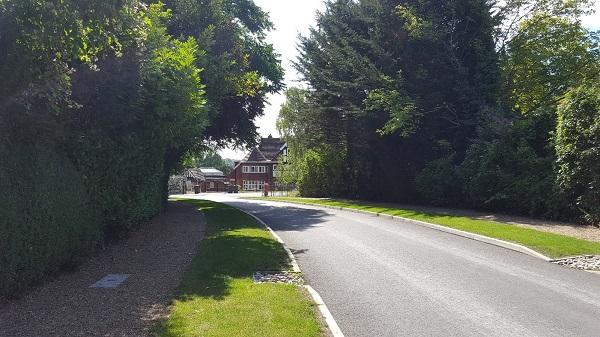
4.5.6 Briar Hill
Briar Hill, connecting South Border, Silver Lane and Furze Hill, was carefully designed to respect and preserve the extensive groups of fir and pine trees that were already present on the land when the road was laid out later in the development of the estate. Its most prominent feature is the diverse array of trees that grow abundantly, with branches extending over the front hedges and often reaching over the road itself.
Public realm
A grass verge, edged with narrow stones, divides the loose gravel footpath from the road.
Boundaries and borders
In front of each plot, there is a border of flowering and foliage trees, backed by a briar hedge that lines the front boundaries. Most of the houses are set back from the boundary, hidden behind their front gardens. Initially, driveways typically had open boundaries, which were later enclosed by either cast iron or timber gates flanked by brick piers.
Layout and form
It is one of the narrower roads within the estate, organically shaped to follow the natural contours of the topography, with gentle elevation changes and curves. Detached houses are set back from the road within well-proportioned plots, with sufficient gaps between them. These large houses, set well apart, are partially screened by mature hedges and shrubbery. On the eastern side, the rear of the plots is bordered by a dense canopy of mature trees.

34. Briar Hill
