3. Townscape character
This section provides an overview of the townscape character of the Webb Estate and Upper Woodcote Village Conservation Areas. Townscape is defined as the arrangement and appearance of buildings, spaces and other physical features in the built and natural environment. Further detail on individual elements within each Character Area is provided in Section 4.
3.1 Layout and plan form
3.1.1 The estate was laid out and planted nearly 20 years before building commenced, allowing the landscape to mature and providing pleasant living conditions for the first residents. Webb personally oversaw the planting of trees and shrubs, as well as the arrangement of other landscape features. The land was cleared of fences, and fifty plots were laid out, each divided by privet hedges. The sizeable plots ensured that architectural styles did not conflict with each other, resulting in a carefully planned layout of clearly defined plots, framed by mature landscaping.
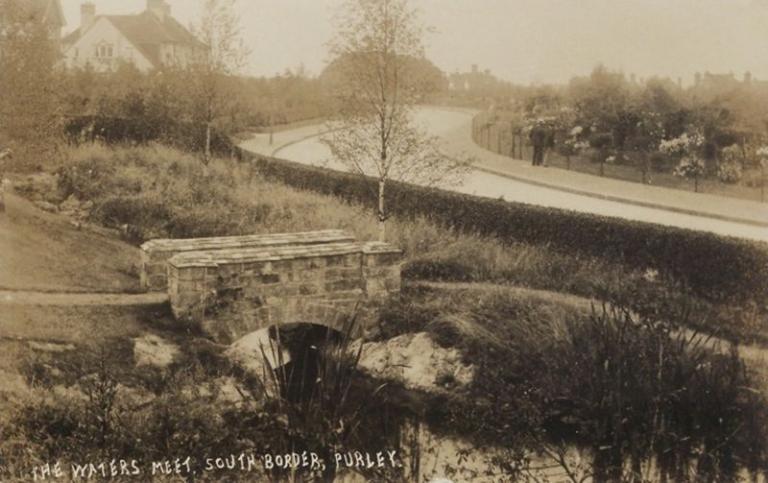
8. The South Border
3.12 The conservation areas are leafy and suburban in character, designed to evoke the charm of country lanes and English garden villages, featuring an organic plan form that was influenced by nature. The estate’s layout evolved gradually, centred around five main roads, each distinctive for their curved rather than straight lines: Woodcote Lane, Rose Walk, South Border, Furze Lane and Silver Lane, with additional roads incorporated later. Some of these roads were developed according to a specific planting scheme.
3.13 The urban grain of the conservation areas can be defined as dispersed, reflecting a low-density development with a scattered yet structured arrangement of buildings and green spaces. The planned yet informal design features widely spaced, organic streets, allowing for expansive back-to-back plots with large front and rear gardens. This plan form creates a strong sense of openness and permeability, while the generous gaps between buildings maintain both visual and physical connectivity with surrounding green spaces. The houses are set well back from the street, with landscaped front gardens enhancing privacy, further reinforced by boundary treatments and mature vegetation
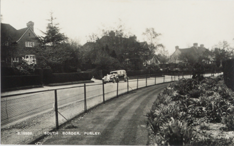
9. The South Border
3.1.4 The plan form of the development is inward-facing, deliberately oriented away from neighbouring developments to create a secluded and self-contained setting. The building lines, footprints, plot sizes, and spacing are highly consistent within each character area, contributing to the planned appearance of the conservation areas. While workers' cottages and lodge bungalows, being of more modest status, were placed on smaller plots and behind more compact gardens, they still followed the estate’s principles. The substantial gaps between buildings and the mature vegetation often obscure the building lines; however, a consistent building line exists behind the gardens, particularly evident along Furze Lane, where semi-detached buildings are spaced more closely together.
3.2 Land use and ownership
3.2.1 The conservation areas are almost entirely residential, originally designed as a quiet suburban area with single-dwelling houses, and it remains so today. This includes lodge bungalows, workers' cottages, semi-detached houses, and large detached residences, each of which are described in more detail in Section 5. In addition to the residential properties, there are several other land uses within the conservation areas, including Cumnor House Primary School and Nursery, Lord Roberts Café, the Village Green (a communal park), Promenade De Verdun (a memorial landscape).
3.2.2 The land was owned by the Webb family until 1999, when it was acquired by the Webb Estate Limited, a company owned by the estate’s residents. Most of the streets are private roads (some gated), owned by the same company, with the exception of Furze Lane, Upper Woodcote Village, Promenade de Verdun and short sections of Rose Walk, Furze Hill and Woodcote Lane, which are part of the unadopted highway.
3.3 Building types, heights, massing and density
3.3.1 The estate is very low density, designed with large garden areas to preserve the rural character of the land. Houses are generally two storeys in height (sometimes with additional roof accommodation) and are well spaced with large gaps and limited intervisibility.
3.3.2 Most houses are detached in their own grounds. There are semi-detached houses on Furze Lane and Silver Lane (some designed to resemble single detached houses) and a small number of semi-detached workers cottages in Upper Woodcote Village. Some of the private roads have single storey ‘lodge houses’ at their gated entrances. In contrast to these more modest residential forms, there are building types such as the schools, which are built to a larger scale.
3.4 Key views and landmarks
3.4.1 Webb Estate and Upper Woodcote Village contain a variety of distinct buildings and key views that create a sense of place. Local landmarks have been identified due to their prominence in the townscape through scale, visibility, historical or architectural interest.
3.4.2 The following buildings and structures in the Webb Estate and Upper Woodcote Village Conservation Areas have been identified as landmarks:
1) Promenade de Verdun War Memorial, designed in accordance with the principles of the French Formal Garden, emphasises geometry and perspective, further enhancing its significance as both a commemorative and historic landmark. The obelisk is an imposing architectural monument which acts as a focal point and is integral to the memorial landscape.
2) Woodcote War Memorial stands on the triangular patch of grass where the three roads meet beside the village green. As a significant landmark on the village green, the memorial contributes to the historic character of the area, serving as a focal point in the townscape.
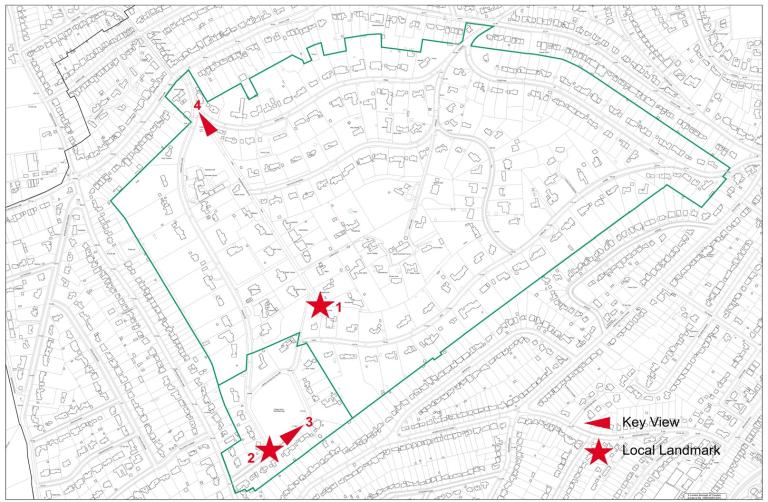
10. Key Views and Local Landmarks
3.4.3 Key views are identified on Map 8. This is a selection of key views. The list is not exhaustive and there may be other views of significance. Any proposals for development within the Conservation Areas, or its environs, should consider the views below and any others which may be relevant or highlighted as part of a bespoke assessment of that proposal.
Woodcote Village South East towards Woodcote Memorial: This view captures the Grade II listed War Memorial within an open setting, where Lord Roberts on the Green forms a prominent backdrop enhanced by surrounding greenery.
Promenade de Verdun North West towards the Obelisk: This view captures the Grade II Listed memorial landscape, featuring a straight avenue of poplar trees leading to the Grade II Listed War Memorial obelisk at its terminus.
3.4.4 The highest point of the estate lies to the north and east, where the land rises above surrounding streets. Furze Hill features the steepest incline, offering limited and partially obstructed perspectives toward the estate’s boundaries particularly when the foliage is reduced in autumn and winter. The most striking scenes are found to the northeast along Furze Lane, where seasonal glimpses be tween buildings reveal rolling hills and suburban houses beyond.
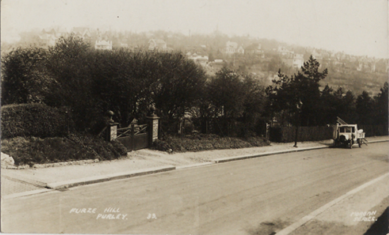
11. Furze Hill
3.4.5 Briar Hill slopes gradually to a vantage point where, on clear days, it was once possible to see five counties -Woolwich to the east, Westminster Abbey and Harrow to the north, and the Chiltern Hills in Buckinghamshire and Berkshire beyond Windsor Castle. However, these panoramic views are now largely obscured by abundant tree cover.
3.4.6 The Village Green gently slopes on its southern side, offering open sightlines across the green and the wider townscape from the northern end, complemented by small clusters of trees planted at its corners.
3.4.7 There are also some striking street vistas, particularly along Rose Walk and The South Border, which are laid out with wide curves and framed by large, impressive houses. Other street vistas are more visually restricted due to mature trees and planting.
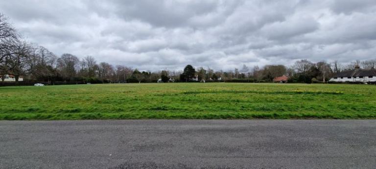
12. The Village Green
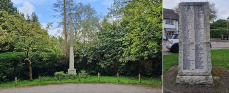
13. Promenade de Verdun and Woodcote War Memorials
