Supplementary Planning Document (SPD). Approved by Cabinet on [dates] and adopted at Council on [dates]
Published by
Croydon Council
Bernard Weatherill House
8 Mint Walk Croydon CR0 1EA
Email: spatial.planning@croydon.gov.uk
Tel: 020 4071385
Image credits
Historic photographs supplied by the Croydon Local Studies and Archives Centre and Croydon Natural History & Scientific Society and Roger Packham unless otherwise specified.
All other photographs supplied by London Borough of Croydon.
Maps reproduced by permission of Ordnance Survey on behalf of HMSO. © Crown copyright and database right 2019. Ordnance Survey Licence Number 100019257, courtesy of Croydon Council
Acknowledgements
Thanks to John Hickman for his advice and input, to the Museum of Croydon, and Croydon Natural History & Scientific Society for kindly contributing images from the John Gent postcard collection. Thanks to Roger Packham for kindly contributing images. Thanks to the archivists at Croydon Archives for their advice and input.
Conservation Area General Guidance
Please read this document alongside the Croydon Conservation Area General Guidance document, available online at: Conservation Area General Guidance
Other supplementary planning documents are also available online via the Croydon Council website Planning pages: Supplementary Planning Documents
Croydon Local Plan
The Croydon Local Plan is available online at: Croydon Local Plan
Contents
1. Introduction
1.1 What is a Conservation Area?
1.2 What is a Conservation Area Appraisal and Management Plan?
1.3 Consultation and community involvement
1.4 Designation background
1.5 Statement of special character
1.6 Character areas
Part 1: Appraisal
2 Context
2.1 Location, topography and setting
2.2 Historic development
3 Townscape character
3.1 Layout and plan form
3.2 Land use and ownership
3.3 Building types, heights, massing and density
3.4 Key views and landmarks
4 Streetscape character
4.1 Greenery, trees and open space
4.2 Public realm
4.3 Boundary treatments
4.4 Streets and character areas
5 Architectural character
5.1 General characteristics
5.2 Historical and architectural significance of buildings
5.3 Character area descriptions
6 Condition, Threats and Development Pressure
6.1 General condition
6.2 Key threats and negative issues
6.3 Development pressure
Part 2: Management plan
7 Additional considerations and designations
7.1 The Implications of conservation area designation
7.2 Statutorily and locally listed buildings
7.3 Registered and locally listed park and garden
7.4 Trees and tree protection orders
7.5 Managing change in the Conservation Area
7.6 Planning enforcement
7.7 Permitted development in Conservation Areas
7.8 Article 4 Direction
8 Development Guidelines
8.1 Demolition
8.2 Development
8.3 Extensions
8.4 Other alterations to roofs
8.5 Window alterations and replacement
8.6 Doors and porches
8.7 Masonry, Brickwork and Render
8.8 External services and fittings
8.9 Boundary treatments, landscape and sustainable gardens
8.10 Energy efficiency improvements
8.11 Changes of use
8.12 Setting
9 Enhancements and recommendations
9.1 General maintenance and improvements
9.2 Public realm improvements
10 Appendices
10.1 Planning policy context
10.2 Useful links

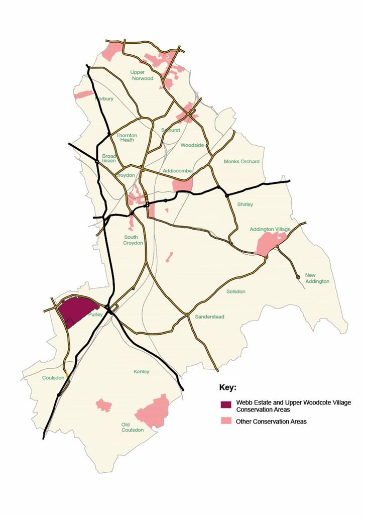
Map of Webb estate and Upper Woodcote Village conservation area
